No doubt GIS is a set of tools and techniques, but to look at it only as a technological fix is to do its socio-economic potential a great disservice
I took a straw poll and asked couple of my well informed friends a question. What does GIS mean? One gave its full form before launching into the technical aspects of how satellites, drones, aircraft and balloons are used to scan an area. Another took it further and told me about how geographical data so captured is used for a lot of practical applications ranging from urban planning, zoning, hydrological and cartographic modelling. Both of them were technically accurate.
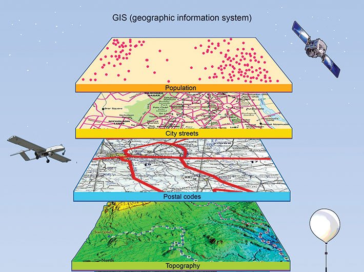
These days geographic information system, or GIS, is primarily identified with digitisation of topographical information. Yet the origins of geoinformatics, as the academic discipline is called, is quite old and goes back over 250 years when a French geographer used colour gradients to depict 48 cholera-affected districts of Paris in the 1830s. But the term GIS was used only in the late 1960s within the context of regional planning by Roger Tomlinson, often considered the ‘father of GIS’. For those interested in a concise and technically accurate definition, GIS refers to any system that captures, stores, manipulates, analyses, layers, manages and presents any form of spatial, topographical, hydrological, cartographic and geographical data.
Now that this technical definition is available, let’s slightly modify the question. What does GIS mean for us? Take time. Think through the definition and you would realise, as I did, that despite its accuracy it does not answer that question at all. So let’s step back from the technology, mathematics, cartography and geography for the moment. In its simplest form GIS tells you about the space that you are living in. Every space that we inhabit needs certain primary, secondary and tertiary social, economic, cultural and physical infrastructure for us to create a good and humane quality of life. At a fundamental level, GIS uses its various tools and technologies to tell you the characteristics of your space: where natural resources like water, fertile land and forests can be found, the specific topographical features and its geographical features.
At a tactical level, it allows a community (a village, town or city) to apportion and structure its space better so that sustainable and good-quality life can be provided. A typical case in point is zoning to contour spaces for a specific set of activities: ranging from transportation hubs, offices, medical centres, commercial centres to residential areas and locations, open spaces, green areas and entertainment blocks. Zoning rules and regulations, if continuously based on GIS, can help in creating an equitable, sustainable and humane way of life.
At a strategic level, GIS allows a community and its leadership and decision-making structures to take a long-term view on resource utilisation, population, migration, changing space utilisation patterns, ecological and environmental sustainability and provision civic services. The point is that GIS, for all said and done, is a great tool, provided the people, community and decision-makers understand its potential and use it in a manner that leads to larger public good. This is the realisation that’s slowly seeping in into the policy circles of India.
There is another way in which GIS can be understood. Today, geoinformatics is deeply enmeshed with digital technology. Everything from figuring out the latitude and longitude to complicated calculations about energy and coal reserves is done using some integrated platform involving software programmes, algorithms and digital devices. The potential for GIS as a tool to be integrated with other digital aids like global positioning system (GPS), different kinds of primary databases (census, NSSO, NFHS, electoral), business analytics and governance intelligence platforms (electronic governance) and digital identity and financial systems (Aadhaar, Jan-Dhan Yojana) is real. Such integration will have a positive multiplicative effect, amplification if one may, on the socio-economic structure of India. What such integration will do is drastically reduce the cost of discovery, comparison and recommendation (DCR).
The world of digital business models revolves around DCR. So the three fundamental principles read something like this: It doesn’t matter if you exist if you are not discovered (hence Google). It doesn’t matter if you are discovered unless there are ways to compare what you are serving (hence comparator sites). It doesn’t matter if you are compared if you don’t get recommended (hence recommendation engines and social media platforms).
In large parts of the country the real world scenario of DCR works in mysterious ways. A small business owner, say a shop selling sweets, either has to hope for his initial customers to spread the word around, or worse shell out money for printing flyers or inserting advertisements in the newspapers. Then the comparison takes place on very subjective parameters, and recommendation, if at all it happens, has to be word of mouth and in friendly neighbourhoods. It usually takes generations for a small business owner to build a brand and a reputation.
An integration of GIS with other digital platforms of identity, authentication, payments and discovery brings down the cost of DCR drastically for small business owners, giving an absolute fillip to socioeconomic activities. The same logic equally applies to accessing social welfare services in a predictable and time-bound manner or an average citizen’s efforts to get basic governance services that he or she so richly deserves.
Such an amalgamation also points to the real opportunity to bring about decentralisation, devolution and hyperlocalisation that puts more direct power into the hands of the people strengthening community-based systems of accountability and oversight. Finally, such a meshed and intelligent system can help, in real terms, people take complete control of precious common resources and public goods. A typical case in point would be open and green spaces that are disappearing rapidly from our cities and towns, appropriated by private builders and the government alike.
Conceiving integrated platforms of digital systems and devices is relatively new. Yet, it has already started taking place in some countries like Denmark, Norway and Germany and closer home in Singapore and Hong Kong. It’s being referred to as spatial data infrastructure (SDI) where “technology, policies, standards, human resource and activities necessary to acquire, process, distribute, use, maintain, and preserve spatial data” are seen in a holistic manner. The big question is this: Is India going to look at GIS as a technological fix or does it have the foresight to see it as one part of an integrated digital system to ensure a superior quality of life?